
I love maps in books. I don’t know why I forget to put a map in every book until somebody reminds me. So for Winding Divide, I’ve been drawing, and then inking.
Two of them are done enough to show. The first is Drialadon, the land of the three coasts and home to the busiest seaports in the world. It’s been a free republic since it bought its independence from the Pileusian Empire, ruled by an elected Prince who is nearly always a merchant of fantastic wealth. All faiths, races, and goods are welcome, so long as they don’t get in the way of trade. Feuds and vendettas are meant to be set aside under the Peace of Drial, though not everyone observes it.
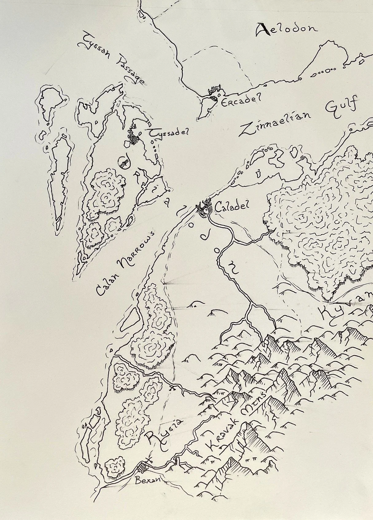
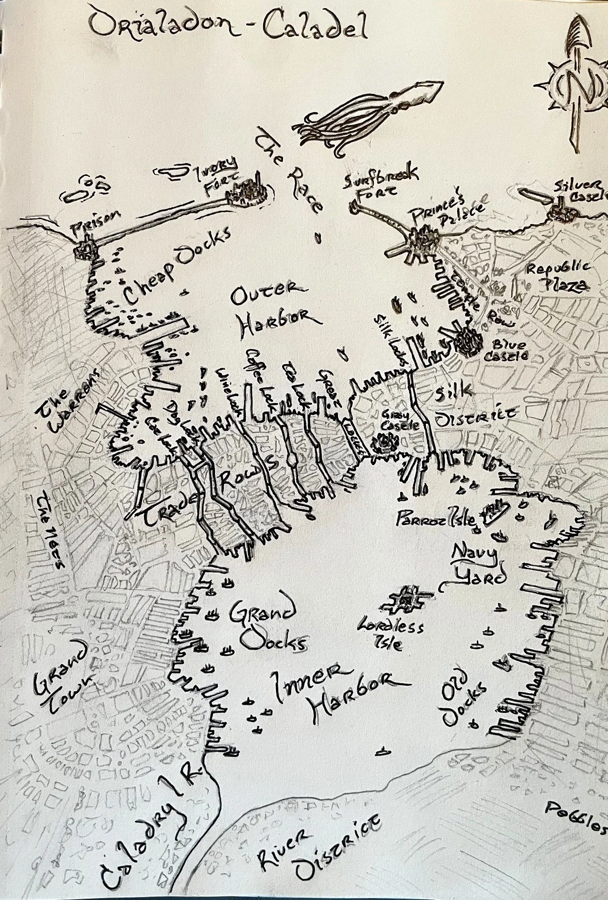
Each of its three ports has its own character. Caladel is the giant, a city of canals and two harbors, where forty-foot tides make loading at the outer piers a frantic business. Ercadel is the questionable cousin, where pirates have been known to sell their plunder back to their victims. Tyssadel is the respectable one, all marble, olive trees, and old money.
The second map is Caladel itself, still mid-ink. City maps are slower. Most of the time goes into drawing out the city blocks, one by one, and then the districts get their names.
If you’d like the occasional map in your inbox, my newsletter, Letters from the Allforger, is here.
Back to the inkwell.